Writer: Roger Nielsen
Georgia’s new interactive maps of broadband internet availability utilize online tools the Institute of Government developed with state agencies and private service providers.
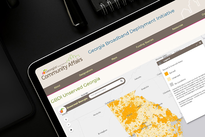
The zoomable maps, unveiled July 1 by Gov. Brian Kemp, precisely identify the availability of broadband service throughout Georgia.
The maps were developed to inform state and private sector efforts to enhance Georgia’s broadband service through the Georgia Broadband Deployment Initiative (GBDI), a multiyear collaboration with the governor’s office, the Georgia General Assembly, the Georgia Department of Community Affairs (DCA), the Georgia Technology Authority and service providers.
Georgia’s new maps show that more than half a million homes and businesses lack access to reliable high-speed broadband service, defined as the ability to download 25 megabits of information per second and upload 3 megabits per second.
Map tools the Institute developed allow users to easily visualize broadband availability at the state and county levels. Pop-up displays show the number of locations that are served and unserved in all 159 counties and at the census block-level in each county.
Georgia communities and service providers now can find accurate, up-to-date information to assist with their broadband planning efforts, according to Institute of Government Director Laura Meadows.
“These maps give Georgia the best picture of broadband service of any state in the country. They will help Georgia and the private sector make more informed decisions about where to make investments and extend service,” Meadows said.
An Institute of Government team of information technology experts and cartographers worked with state agencies and internet service providers to collect broadband availability data from providers, collect location data from public sources, verify the data, create zoomable maps showing broadband availability and build out the GBDI website where the maps are publicly available.
The Institute, working with the Georgia Department of Education and others, also helped the DCA develop an interactive map that shows where public wi-fi access is available across the state.
In addition to helping families find locations where students can continue their studies online, this information helps school districts determine the best locations to establish school-based and bus-based wi-fi hotspots for students who don’t have high-speed internet service at home, according to Eric McRae, Institute associate director for information technology and outreach services. School districts can also utilize this information when applying for funding through the federal Coronavirus Aid, Relief and Economic Security (CARES) Act to support online learning, McRae said.
Shown above: Interactive maps that provide a detailed picture of where broadband internet service is available in Georgia were developed through an Institute of Government partnership with the Georgia Technology Authority, the Georgia Department of Community Affairs, other state agencies and the private sector.